
 RURTECH
The Story
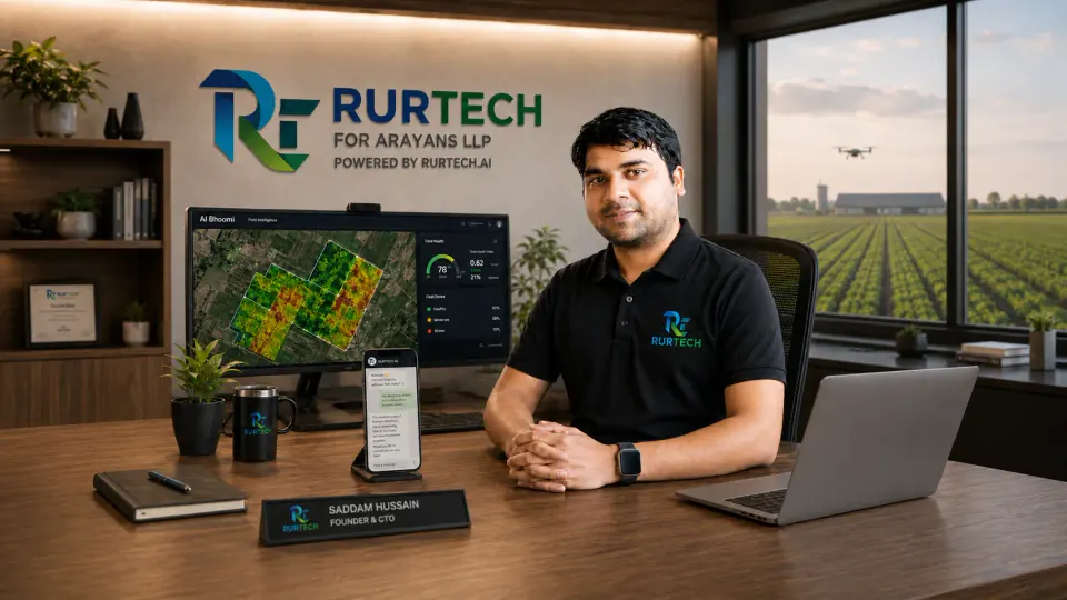
RURTECH, which operates as RURTECH FOR ARAYANS LLP, is building an agricultural intelligence stack that combines satellite imagery, weather, soil and other geospatial datasets to produce advice for individual farm parcels rather than for districts or blocks.
Its farmer-facing product, AI Bhoomi, delivers that advice through WhatsApp in twelve languages, which removes the need for a farmer to download and learn a separate app. The company says there is no minimum landholding: a farmer with a tenth of a hectare is served on the same parcel-level terms as one with ten.
The company was founded by Saddam Hussain, its chief executive, after thirteen years in industrial audit. Nabi Hussain is a designated partner of the LLP.
From 15 July to 4 August 2026, RURTECH's live system handled 1,875 messages, 923 incoming and 952 answered, from 134 farmers, with 74 plots mapped to a location across 17 states and 34 districts. The holdings ranged from 0.01 acre to 100 acres, with a median of two.
A white-label pilot with Gramik, the agri-input and rural commerce platform operated by Agriprojunction Ventures, began on 7 August and runs to 6 September across Barabanki, Saharanpur and Unnao in Uttar Pradesh. It is designed for up to 10,000 farmers, with RURTECH supplying the intelligence layer and Gramik delivering it under its own brand. The company is separately developing a model in which farmer producer organisations access the dashboard without an annual licence fee and are paid when farmers are onboarded.
RURTECH says it was among the startups selected to pitch at Vande Bharatam, the national innovator search Gautam Adani launched on 25 June 2026. All operating figures in this article come from the company.
Why It Matters
A farmer in Uttar Pradesh may own three acres of paddy, and those three acres do not necessarily behave like the rest of the village. One parcel may be retaining too much water. Another may be under moisture stress. A third may already be showing early vegetation changes that are difficult to notice from the ground.
Yet most agricultural information in India is still delivered at district, block or village level. A forecast broad enough to cover a whole block cannot tell any individual farmer which part of their own land needs attention first.
A satellite image on its own does not close that gap either. NDVI charts, radar imagery, rainfall models and soil datasets become useful only when they answer a practical question: is my crop under stress, does this field need irrigation, what changed in this parcel this week, is the coming rainfall enough. That translation layer, from Earth observation data to an agricultural decision a farmer can act on, is where RURTECH is positioning itself.
The delivery choice follows from the same logic. Advice sent over WhatsApp in the farmer's own language asks nothing of them that they are not already doing, whereas an app requires a download, a login and a reason to return.
Radar matters for a specific reason. The Indian growing season is the monsoon, and optical satellites cannot see through cloud when the crop most needs watching. RURTECH's stack includes access to NovaSAR-1 through CSIRO, an S-band radar mission that images through cloud, rain and dust, and releases its Level-1 products openly.
What none of this removes is the fieldwork. Someone still drives out, sets up a projector against a bedsheet in a village yard after dark, and explains to farmers what a soil card is. That cost sits underneath every number the company reports.
The Strategic Read
Hussain's route into the problem is unusual. Thirteen years in industrial audit trained one instinct: look for the gap between what is reported and what is actually happening. Turned on Indian agriculture, that instinct found forecasts too broad to act on and soil stress invisible at field level.
What followed is the part of the story the company does not smooth over. A resignation letter, a cracked laptop, no co-founder, no institutional capital and no office. One of the first operating setups was the back seat of a car in Nalgonda. The family question was blunt, and the market's answer was not much softer: advisors suggested skipping the farmer entirely and selling data to banks instead, on the grounds that the problem was real but the business model too hard.
The strategic bet that came out of that is about distribution rather than technology. India does not need every farmer to become a geospatial analyst. It needs the intelligence to disappear behind interfaces farmers already use and organisations they already deal with: FPOs, agri-input companies, rural commerce networks and WhatsApp. The Gramik pilot is the first test of that, and it is deliberately structured so the farmer never encounters RURTECH's brand at all. If it works, it matters more than another standalone agritech app.
The open questions are substantial and mostly technical. Satellite-derived soil estimates need rigorous ground validation before anyone should treat a soil card issued from orbit as equivalent to a lab test. Advisory accuracy has to hold across crops, seasons and regions rather than in one district. And farmer engagement has to survive past a pilot in which onboarding is done by hand.
The live numbers are honest about the stage: 134 farmers, not 134,000. The direction is worth watching, but the evidence so far is three weeks long.
For daily, sharp analysis of the biggest moves in the Indian business and startup ecosystem, follow StartupFox.